The Tampa Bay Area has experienced tremendous growth in the decade since
83 Degrees Media launched in November 2009.
We’ve tracked many of the changes and evolution in local technology, innovation, diversity, and the environment through about 4,000 stories published over that time.
And we’ve also seen the physical and cultural transformation of our community, which is becoming more walkable, more urban, and more vibrant with each passing year. New technology, greater innovation, increasing diversity, and growing concern for and better understanding of the environment have helped guide much of the growth throughout the Tampa Bay Area in recent years.
So we thought it would be interesting to take a look at Google images over time because Google launched the popular Google Street View feature in 2007 and the Tampa Bay Area was one of the first metropolitan regions in the country to see its highways and byways mapped with this then-innovative, you-are-there technology.
Thankfully, Google Street View archives are available for all to enjoy, allowing with a few simple clicks to see what the surrounding scenery looked like from nearly any mapped street since the first images were taken by the Google team. This allows us to take a virtual trip back through time to a decade ago, so we can “see” what some of the Tampa Bay Area’s most popular and important landmarks and attractions have changed over time.
So, let’s hop into the Google Street View time machine and take a trip back to see what a dozen of the most important local landmarks and destinations were like when 83 Degrees first hit the scene and compare them to how they look now. We think you'll agree that the evolution of our beautiful community is stunning.
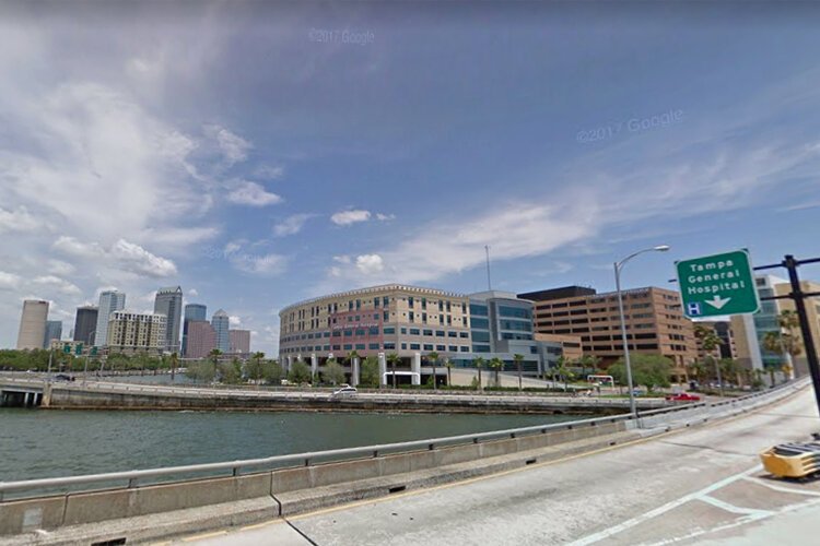
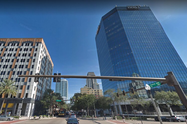
Downtown Tampa, Tampa General Hospital
![]() DowntownTampa (2009)
DowntownTampa (2009)This view from May 2009, looking northwest from the bridge connecting Davis Island to Bayshore Boulevard, shows a then-recently expanded Tampa General Hospital in the mid-ground and the downtown Tampa skyline in the background.
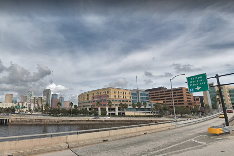
While the images from 2009 and 2019 look vastly similar, you’ll notice some important differences that highlight construction along upscale Bayshore Boulevard nearing downtown.
![]() DowntownTampa (2019)
DowntownTampa (2019)There are several more recent mid-rise condominium developments, including the white-colored 2 Bayshore Apartment Homes on the left of the newer 2019 image.
Farther in the background showing the downtown skyline, the 460-foot-tall Park Tower, built in 1973 and colored brown for most of its existence, is now painted white.
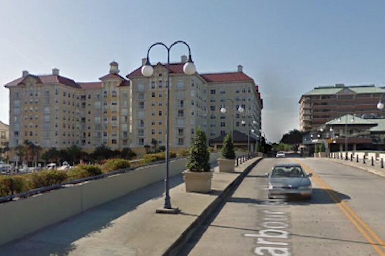
Harbour Island Tampa
![]() Harbour Island (2009)
Harbour Island (2009)The recent initiatives to make downtown Tampa a live-work-play community can be traced back to the creation of Harbour Island, the waterfront community located just south of the Tampa Convention Center and across a channel from Davis Islands.
When Beneficial Land Corporation unveiled the 177-acre community in 1985, it was connected to downtown Tampa by an elevated electric tram system called the Harbour Island People Mover.
The urban community, anchored by a variety of retail, office, and residential developments, was
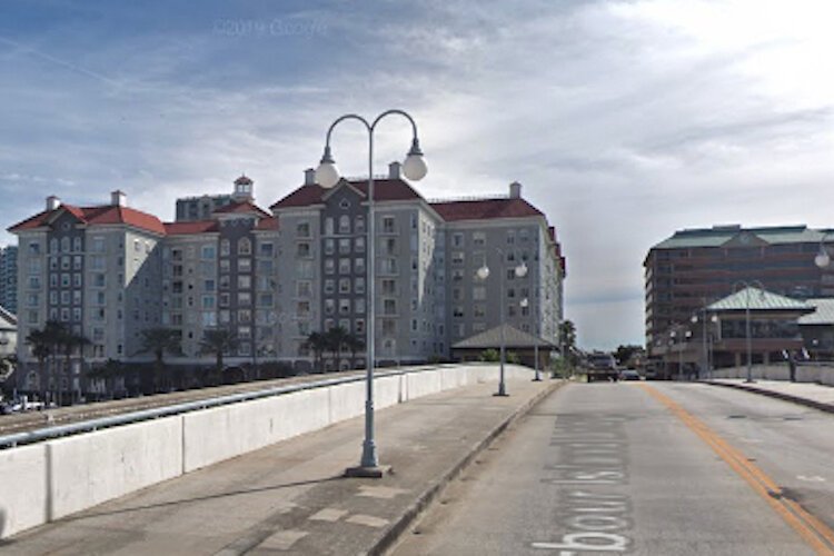
![]() Harbour Island (2018)
Harbour Island (2018)hailed by many as a vision for Tampa’s future.
The earlier photo here was taken in May 2009, by which time the community had been mostly built out.
Few major physical transformations came over the next decade, with the Harbour Island skyline looking much the same in the December 2018 Google Street View.
Water Street Tampa
The
Water Street Tampa wellness district development
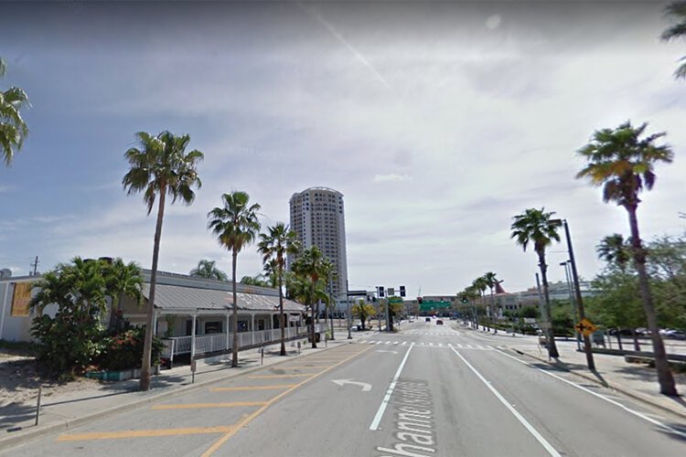
![]() Water Street (2009)
Water Street (2009)is reimaging the community immediately surrounding the Amalie Arena, Tampa Bay History Center, and Florida Aquarium as an exciting live-work-play hub. Centered around some of Tampa’s most important landmarks and just steps from the water along Tampa’s Riverwalk and
Sparkman Wharf, the 50-acre Water Street Tampa neighborhood will combine residential, retail, education, and tourist attractions all within a vibrant, walkable community. As seen in the May 2009 image, there wasn’t much going on along Channelside Drive – at least not when there wasn’t a Tampa Bay Lightning hockey game or concert going on!
The single-story restaurant then
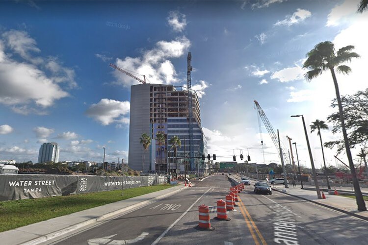
![]() Water Street (2016)
Water Street (2016)known as The Hut is long-gone by the time the January 2019 Google Street View photo was taken. The
tall building seen under construction in the 2019 photo is the University of South Florida (USF) Health Morsani College of Medicine and Heart Institute, which, once completed, promises to be an integral player in the Water Street Tampa community. Imagine what this scene will look like in 10 more years. If the multi-billion-dollar Water Street Tampa development unfolds as projected, the scene along Channelside Drive in 2029 will look unrecognizable from how it appears today.
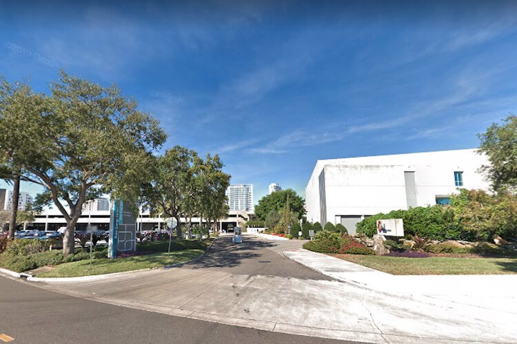
USF Tampa Campus
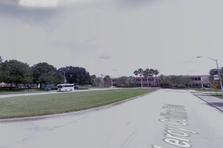
![]() USF Tampa (2008)
USF Tampa (2008)Just as the Morsani College of Medicine and USF Health building in Water Street Tampa in downtown is growing upward, so, too, is the school’s main campus in North Tampa at 4200 East Fowler Avenue.
The earlier photo, taken on-campus in late 2008 from the northwest-oriented vantage point of Lee Roy Collins Boulevard near the school’s library building, shows little ornamental landscaping and an even more barren skyline.
Ten years later, in December 2018,
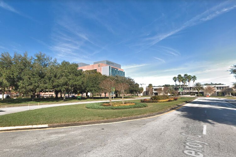
![]() USF Tampa (2018)
USF Tampa (2018) the 238,500-square-foot Interdisciplinary Sciences Building stands tall.
The facility, which opened in July 2011, houses several integral programs of USF’s chemistry, physics, and biology departments and has helped the school become one of the top 50 research universities in the United States as ranked by the National Science Foundation.
Ulele Tampa
Many wonderful, innovative restaurants have
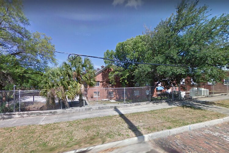
![]() Ulele (2009)
Ulele (2009) opened in Tampa during the past decade, but one of the most important is none other than
Ulele. Named for a local Native American princess, Ulele vibrantly blends a variety of recipes and dishes from the native community and the surrounding waters.
The epicurean landmark, founded by Columbia Restaurant owner Richard Gonzmart, debuted in May 2014 in a transformed version of Tampa’s historic Water Works Building, which originally opened in 1906.
The earlier image, taken on Highland Avenue in May 2009, shows a fenced-off and abandoned Water Works building as it appeared three years
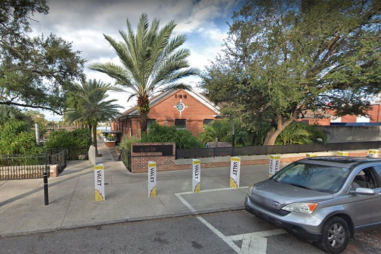
![]() Ulele (2018)
Ulele (2018) before the formal announcement came that Gonzmart would open his Native American-inspired restaurant there.
Today, Ulele enjoys much attention and big crowds. The more recent image from November 2018 shows the valet parking area near the restaurant at 1810 N. Highland Avenue, which is buzzing with the activities of an overflowing crowd on most any given evening or weekend afternoon.
MidTown Tampa

![]() Midtown (2008)
Midtown (2008)For decades, the West Tampa neighborhood has been known for its working-class homes and generations of Latin families situated between downtown and Westshore.
But a transformation is now underway near the intersection of North Dale Mabry Highway and West Cypress Street. Dubbed “Tampa’s new urban district,” the 22-acre
MidTown Tampa development will bring 1.8 million square feet of retail, residential, and Class-A office space, entertainment, and hospitality.
The innovative walkable community will also feature greenspace and a recreational trail centered around the three-acre Midtown Lake.
![]() Midtown (2019)
Midtown (2019)In the 2019 image, one can see much construction activity at the site, bounded by fencing and banners advertising the multi-phase project.
The earlier image, taken in late 2008, shows a scene there that was relatively unchanged for decades.
The MidTown Tampa site was formerly occupied by a hodgepodge of mixed developments, including a gas station, a multi-story insurance building, restaurants and diners, and several low-scale industrial and commercial operations.
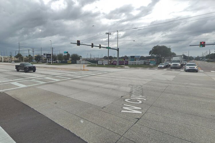
Gulf-To-Bay Boulevard, Clearwater
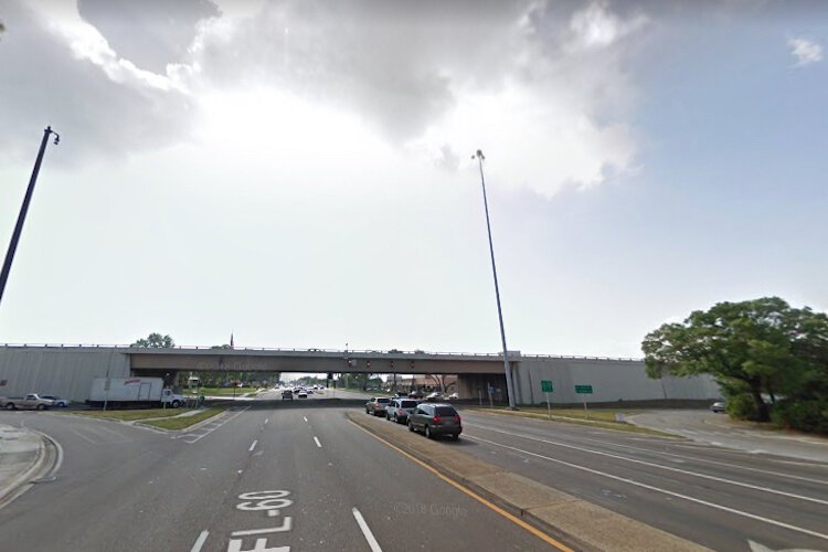
![]() U.S. 19-S.R. 60, Clearwater (2009)
U.S. 19-S.R. 60, Clearwater (2009)Let's go across the Bay. ...
Where else to start there but the intersection many motorists encounter when traveling through Pinellas County?
That, of course, is the intersection of State Road 60 (Gulf-To-Bay Boulevard) and U.S. Highway 19.
These scenes, looking east from a vantage point on S.R. 60 near the U.S. 19 overpass, represent a Tampa Bay motorist’s worst nightmare – even if that’s not immediately evident from the relatively empty roadways seen here.
The biggest problems? Rush-hour gridlock throughout the week and a snarl of tourist traffic
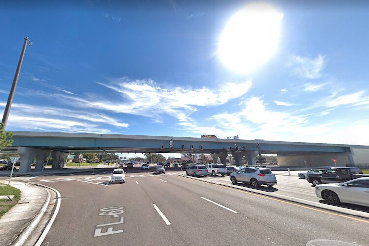
![]() U.S. 19-S.R. 60, Clearwater (2019)
U.S. 19-S.R. 60, Clearwater (2019)during spring break and the summertime holidays.
Construction had yet to begin on widening the U.S. 19 overpass as seen in the 2009 image.
Today, the U.S. 19/S.R. 60 intersection operates much more efficiently, with two new U.S. 19 overpasses, new onramps, and offramps to and from the elevated highway, and a realigned Gulf-To-Bay Boulevard.
Traffic still gets thick here, but it’s hard to imagine life in central Pinellas County without the multi-million-dollar modifications made at this intersection in the mid-2010s.
Clearwater Beach
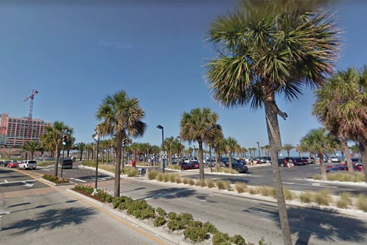
![]() Clearwater (2009)
Clearwater (2009)Much of the traffic encountered at the busy intersection of State Road 60 and U.S. Highway 19 is caused by tourists heading to and from Clearwater Beach, a community that hasn’t stopped growing at any point in the last several decades.
The changes at the popular Clearwater Beach are evident between the two Google Street View images taken a decade apart and shown here.
In the background of the May 2009
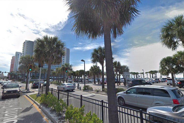
![]() Clearwater (2019)
Clearwater (2019) image, taken on Coronado Drive and looking southwest toward the beach, construction continues on the Hyatt Regency Clearwater Beach Resort and Spa.
The Hyatt was completed in 2010.
And in the 2019 image is obscured from this vantage point by the 750,000-square-foot Wyndham Clearwater Beach Resort, which opened in 2017 as the largest development ever on Clearwater Beach.
Downtown St. Petersburg
![]() Downtown St. Pete (2008)
Downtown St. Pete (2008)The city of St. Petersburg has significantly transformed over the last decade, growing into one of the most dynamic larger cities along the West Central Florida coast.
Its unique blend of culturally significant museums, diverse restaurants, innovative retail, and upscale residential developments all in an increasingly walkable urban community serves as a model for many cities throughout Florida.
The downtown St. Petersburg skyline has also changed much over the last decade, with more residential and multiuse high rises hitting the scene.
![]() Downtown St. Pete (2019)
Downtown St. Pete (2019)This 2008 Google Street View image, taken on Central Avenue and 4th Street in September 2008, prominently showcases the city’s Municipal Services Center (left) and 17-story First Central Tower (right), with the familiar 28-story One Progress Plaza, with its mansard-style roof, standing in the background.
Today, these buildings are joined by One St. Petersburg, a white-colored 450-foot-tall condominium complex that opened in 2015 and is seen in the background of the more recent image.
Central Avenue, St. Petersburg
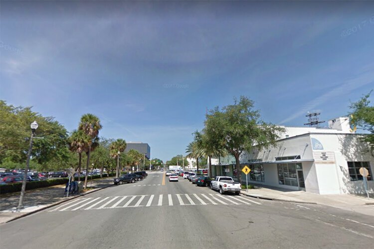
![]() 700 Central Ave (2009)
700 Central Ave (2009)Critical to the transformation of St. Petersburg as into a vibrant small city is the Central Avenue corridor, which runs east-west across town, connecting both waterfronts.
It is where funkier epicurean establishments, such as Right Around The Corner Arcade Brewery, Casita Taqueria, and Bandit Coffee Company mingle with longtime standbys such as Ferg’s Sports Bar & Grill, Acropolis Greek Taverna, and Datz.
And that’s not even including the many other types of businesses and
![]() 700 Central Ave (2019)
700 Central Ave (2019)organizations along Central Ave, including Haslam’s Book Store, Central Neurology, Morean Arts Center, and the St. Petersburg Police.
The two images here, looking west from 700 Central Ave., show what life was like in this hip part of “The Burg,” just beyond the shadows of the downtown skyscrapers.
Not much was going on at this corner in 2009, but a decade later in 2019, we find Banyan Café and Catering on Central at the right side of the image and to the left is Rawk Star Café St. Pete, Chihuly Collection art gallery, and a Publix supermarket, with more mixed-use growth apparent in the background of the more recent street view.
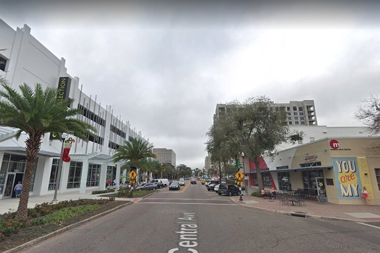
Mahaffey Theater & The Dali, St. Petersburg
![]() Dali Museum site (2008)
Dali Museum site (2008)Two of St. Petersburg’s cultural crown jewels are the Mahaffey Theater and The Dali museum.
The site shown in both of these images has been a cultural hotspot since the 1960s.
On May 1, 1965, the Mahaffey Theater and adjoining Bayfront Center arena opened as a single entertainment complex, bringing all forms of entertainment to St. Petersburg for decades.
In 2004, the 5,800-seat arena was demolished, but the Mahaffey Theater was left standing, with a massive $20 million renovation performed afterward on the 2,031-seat performing arts building.
![]() Dali Museum parking entrance (2018)
Dali Museum parking entrance (2018)In the meantime, the land cleared by the demolition of the Bayfront Center was eventually dedicated to building an innovative and architecturally unique facility for the museum housing the works of
Salvadore Dali, which originally opened in 1982 in a former marine warehouse building a few blocks away at 1000 3rd Street South.
When the earlier image here was taken in late 2008, plans had just been announced for construction of The Dali on the former Bayfront Center site.
Today, the new Dali museum stands alongside the Mahaffey Theater, more formally known as Duke Energy Center for the Arts – Mahaffey Theater, just a few yards away from the beautiful waters of Tampa Bay.
St. Pete Pier
The
St. Pete Pier has undergone several
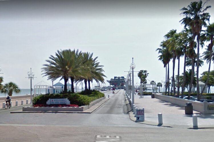
![]() St. Pete Pier (2009)
St. Pete Pier (2009) transformations over more than a century.
The Pyramid Pier seen in the May 2009 image opened in 1973 and was built on a pier head originally constructed in 1926 for The Million Dollar Pier, which was demolished in 1967.
The Pyramid Pier underwent major renovations in the mid-1980s, but the aging landmark failed to attract the crowds necessary to keep the pier financially viable into the 2000s.
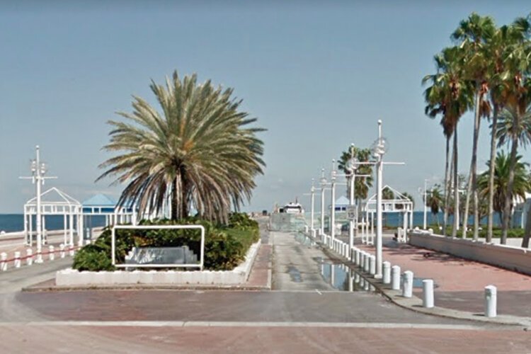
![]() St. Pete Pier (2016)
St. Pete Pier (2016)Further dooming the Pyramid Pier was the deterioration of its underlaying supporting structure and 1,400-foot approach, built for The Million Dollar Pier in the 1920s.
The Pyramid Pier closed in 2013 and was demolished in the fall of 2015.
The 2016 image, the latest Google Street View available from this vantage point, shows demolition of the original 1926 pier approach, one of the last steps before construction began in 2017 for the new St. Pete Pier, slated to open in 2020.