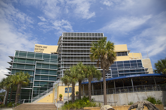
Pirates, shipwrecks and maps await visitors to expanded Tampa Bay History Center
Tampa prepares to set sail on a journey with pirates through shipwrecks and an extensive Florida map collection as the Tampa Bay History Center opens a brand new permanent exhibit.
With the opening of a new fourth floor, the Tampa Bay History Center is charting a course for growth, and it’s using maps and nautical treasures from the past to bring this long-awaited expansion to fruition.
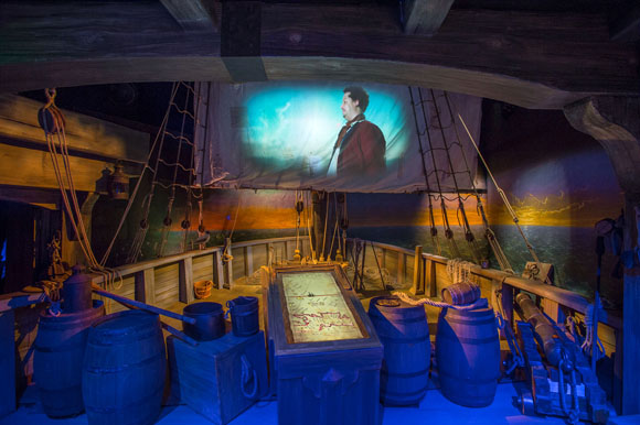
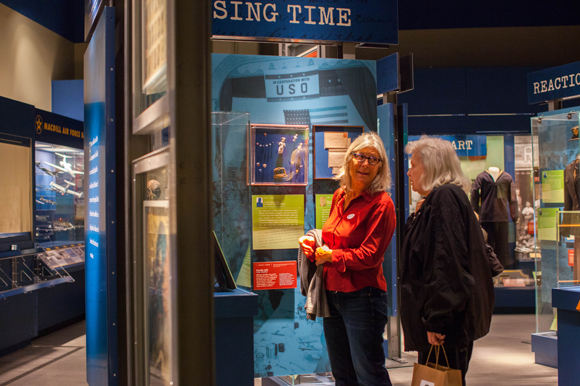
The 8,500-square-foot expansion includes an interactive exhibit called Treasure Seekers: Conquistadors, Pirates & Shipwrecks and a special annex that houses the Touchton Map Library and the Florida Center for Cartographic Education.
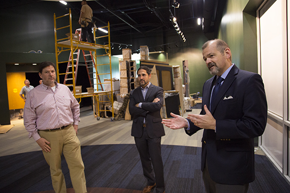
The enhancements, which began construction in early 2017 and officially opened to the public on Sunday, Feb. 18, increase the museum’s exhibition space by an additional one-third. It completes a long-planned expansion for the almost 10-year-old museum, and covers more than 12,000 years of regional history.
Smooth sailing ahead for museum expansion
“We had planned the additional gallery in 2009,” says Tampa Bay History Center CEO C.J. Roberts, citing economic factors during the Great Recession that led to stalled efforts on building the space during the museum’s original construction.
“But we had always planned to eventually turn this into an exhibition space,” he continues, standing in a freshly painted gallery space that houses the Treasure Seekers exhibit. “We had been asking museum guests for years what they would want to see go into this space once we built it out. Many respondents wished to see something about pirates, which we celebrate in Tampa every year with the annual Gasparilla pirate parade,” referencing the popular event that unfolds on Bayshore Boulevard each winter and draws more than 500,000 revelers.
Roberts explains that the Tampa Bay History Center staff thought a pirate-themed exhibit would be an excellent addition to the facility, but there was one major problem standing in the way.
“What do you say about pirates when there really is no written account of them?”
Even the iconic Jose Gaspar, the namesake of the Gasparilla parade, is almost certainly a mythical figure. Claimed to be the “Last of the Buccaneers,” Gaspar supposedly lived from about 1756 through 1821 and sailed the high seas of the Gulf of Mexico, yet he left behind nary a known artifact, nor have any contemporaneous records about him or his adventures turned up in Florida or his native Spain. Thankfully, the museum was not without options for telling the pirate story, even with few, if any, historic leads to go on.
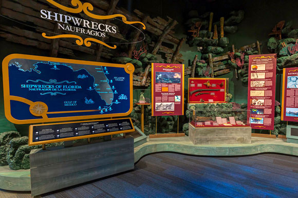
“There were other things we wanted to tie into this exhibit, including shipwrecks, which are a big part of pirate lore,” Roberts says. “We talked to the folks at Odyssey Marine and told them we were going to build an exhibit that covered not just pirates, but also shipwrecks.”
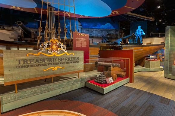
The artifact-rich Treasure Seekers exhibit includes items recovered by Odyssey Marine researchers and several other contributors from the Tampa Bay Area and throughout Florida.
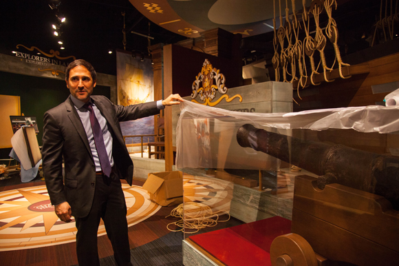
Among the gems is an 11-inch bronze bell from the Spanish ship Senora del Rosario, which sunk in 1622 during a hurricane near the Dry Toratugas in a fleet that also included The Atocha.
“The bell would have been the last thing people aboard the ship would have heard as they were sinking,” notes Tampa Bay History Center Curator Rodney Kite-Powell.
Another significant artifact on display in the new Treasure Seekers area is a 1660s astrolabe, which is a type of instrument that came before the sextant and used to make astronomical measurements and calculate latitudes by assessing the altitude of celestial bodies such as stars and calculating latitude.
“It took us about 18 months to acquire the artifacts that will be on exhibition here,” he continues.
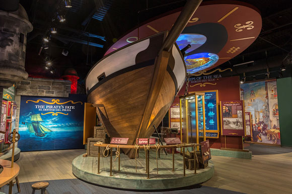
The centerpiece of the Treasure Seekers exhibit is a 60-foot-long replica of a 1600s Bermuda sloop, a ship commonly used by many seafarers during the height of the pirate era romanticized by so many today. In addition to the dozens upon dozens of artifacts and the massive ship replica will be a unique, interactive theater with a 360-degree-wide, 180-degree-tall movie screen that takes guests on a treasure hunt adventure.
Mapping a new frontier
What do treasure hunters need when they are looking for their bounties? Maps.
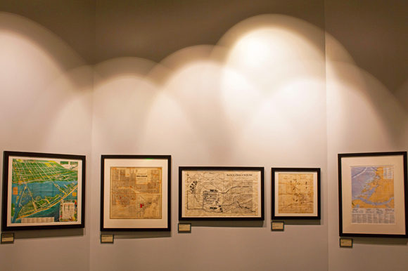
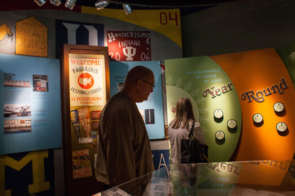
And maps are exactly what museum guests will find in a new exhibit area immediately adjacent to Treasure Seekers. The new exhibit houses 50 to 60 maps, including five to six maps that will be permanently on display, including a 1513 map of the New World.
“The maps on display in the entrance area of the map exhibit will tie into the Treasure Seekers exhibition and segue guests into the map gallery,” Kite-Powell explains. “A video screen will greet guests, using an interactive timeline to illustrate the history of map making going back to 1513.”
The museum already had a map gallery but the new space will represent an increase in size for its cartographic material by some 50 percent, and the current map gallery will become a flexible space for a variety of uses.
Much of the increase in size and scope for the Tampa Bay History Center’s map collection is thanks to a generous donation of more than 4,000 maps and related artifacts by Thomas Touchton, the head of a local investment firm who led the effort to build the Tampa Bay History Center beginning in the late 1980s.
The cartographic center, which is being named in Touchton’s honor, will be operated in partnership with the University of South Florida (USF). Researchers will have free reference access to the map collection.
“We have so many opportunities with Mr. Touchton, USF, and other partners around the country to create a variety of map exhibits here,” Kite-Powell says. “One of the highlights will be a map from 1513 and a map created by Benjamin Franklin describing investigations of the Gulfstream. Many maps here are unique.”
With a virtually unparalleled collection of Florida maps ranging from railroad maps and Howard Johnson brochure maps to survey records and more, the Tampa Bay History Center offers a wealth of cartographic treasures for researchers. “The cartographic collection is a collaboration with USF and will allow researchers to come here, study the maps, and hopefully use them for publications and other projects.”
While the Touchton Map Library and the Florida Center for Cartographic Education will undoubtedly welcome countless casual researchers and dedicated cartographic experts, those who wish to view material in the Touchton Map Collection won’t necessarily have to venture to the museum to explore the materials, which were made as early as the 1500s up to the 2000s.
“We’re having the collection digitized and will eventually digitize the entire collection,” says Kite-Powell. “A county grant is paying for the digitization,” a multi-year project performed by Creekside Digital of Glen Arm, MD.
“Some of the scanning equipment is worth more than your house. It takes pictures of the maps in segments like tiles and then puts them together to create a picture of the entire map,” explains Kite-Powell, who will become the curator of the Touchton Map Library and the Florida Center for Cartographic Research. “We’ve never done anything like this before.”
The news excites researchers like USF Special Collections Assistant Librarian Andrew Huse, who will be working with officials at the Tampa Bay History Center throughout the digitization of the Touchton Map Collection.
“When it comes to maps, you’ve got the biggest players in the Tampa Bay Area joining forces,” he says of the USF-Tampa Bay History Center partnership. “We work very well together,” continues Huse, whose USF library department contains thousands of maps and related materials. “We’ve done many things together over the years, such as Florida Conversations [a history lecture series], though this is the largest project we’ve worked on together.”
In addition to the maps in the Tampa Bay History Center collection, many materials in the USF Special Collections library are also earmarked for digitization.
“We’re both working in tandem,” he adds. “This brings awareness to what we do at USF – the Special Collections department has been a well-kept secret in the community. This is an opportunity to raise our profile of the materials in the Special Collections Library and at the Tampa Bay History Center.”
One of the most important benefits of the synergy between USF and the History Center, Huse says, is helping to bring students closer to invaluable historical reference materials and also creating a more accessible pool of archival information.
“There’s no lack of love for history. But what I’ve noticed in going around the state attending lectures is that a lot of history is fragmented in different places,” Huse observes. “With USF and the History Center working together, it’s a chance to create a better, wider history network.”
Building a cartographic legacy
For Thomas Touchton, his place in Tampa history was crafted in October 1982 during an adventure in London, where he helped his wife celebrate her 40th birthday.
“We went to a neighborhood antique fair and were looking for classic books, but we couldn’t find many,” he explains. “We did find one guy in a corner selling antique maps, and he had some on a wall. I asked him what he was selling, and he said, ‘maps.’ I said ‘who buys maps?’ and he explained to me their value to historians, in studying geopolitics, for use as a teaching tool, and also how they were used as visual aids at a time when fewer people knew how to read.” He added, “I bought a map that day – it was serendipitous.”
Touchton says he knew if he wanted to really make his collection great, he would have to focus in one area of cartography.
“I decided to focus on maps from Florida, as the state is important historically, it has a unique shape relative to other states, and it is also where my wife and I are from. I wanted to build a body of knowledge about Florida maps.” The Touchton family is originally from Dade City in Pasco County.
His interest in maps charted him on an eventual path to helping found the Tampa Bay History Center.
“I had been collecting maps for about six years when some Tampa friends who were part of a task force behind establishing a museum for regional history approached me. They knew I collected maps and was interested in history, and they wanted to see if I could spearhead the effort to build a museum here devoted to local history.” He soon became chairman of the Board of Trustees and served in that role until 2000. “It took 23 years to build the Tampa Bay History Center from the inception of the task force [in 1986] to opening day.”
For Touchton, the inclusion of his map collection in the History Center’s new exhibit area and cartographic research center brings things full circle. It was his maps, after all, that helped put him on the path to bringing the museum to fruition.
“This will be one of 10 cartographic research centers in the United States and the only in the Southeast,” he says. “The next nearest is the Library of Congress in Washington, D.C., to the north and the University of Texas in Austin to the west.”
Meanwhile, Touchton’s “very Florida focused” map collection will fill many voids that, until now, have been left vacant for Sunshine State cartographic researchers, especially those who are working in conjunction with USF. “Maps can be used by USF educators in various ways. You can learn geography, international relations, and art through maps.”
In addition to the digitization of the map collection, Touchton is excited about the possibilities for future exhibition opportunities.
“We will have new map exhibits every several months, changing the themes over time. For example, we could have an exhibit featuring railroad maps, another showcasing shoreline maps,” he says. “And there’s another subject both Rodney [Kite-Powell] and I like, and it’s an exhibit of maps that show development that did and did not happen in Florida. With land boom and land bust cycles and other economic tides, there were many proposed developments that were placed on Florida maps but that never came to fruition.”
Touchton suggests another type of exhibit might focus on maps of various languages, of which his alone reflect a wide range, including German, French, Dutch, and Spanish.
His favorite map is one from 1861 titled “Birds-Eye View of Florida,” illustrated by cartographer John Bachmann. “If you could look at 15, 30, or 50 maps, you’d probably say this was my favorite,” he explains. “The map is drawn from an altitude perspective. Bachmann had to really use his imagination when drawing this map, which includes railroad lines, rivers, and even U.S. military forts.”
He concedes it’s actually difficult to pick a favorite. He says each map is special, and picking a favorite would be as difficult as picking a favorite among his children or grandchildren.
His collection of maps, like so many precious children heading off to university, will soon co-mingle among students and researchers from USF and thousands of others who will learn from the material Touchton is bestowing to the museum piece by piece.
“I haven’t given the entire collection yet,” he clarifies. “I’ve contributed about 1,000 pieces so far and will be giving more over the next several years.”
To suggest additional story ideas, email 83 Degrees.
To subscribe to our free weekly e-magazine, follow this link.
Author
Related Articles
Slowing down Ybor City’s Seventh Avenue
Tampa officials unveil safety improvements on Ybor’s Seventh Avenue following high speed chase and crash that killed four.
HIPPY delivers home lesson in early learning
HIPPY gives preschool parents the materials and mentoring to begin their child’s educational journey.
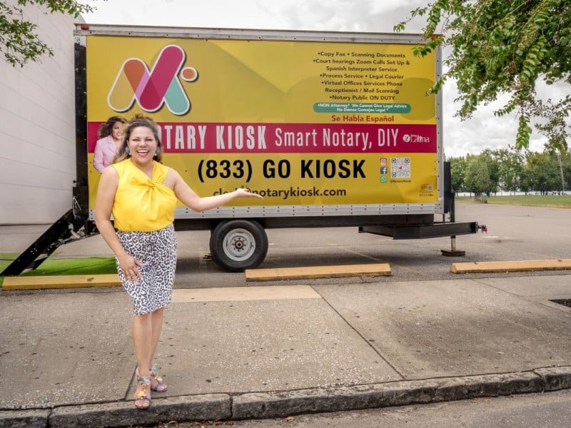
Downtown Tampa’s Notary Latina finds a great space
In a parking space outside the downtown Tampa courthouse, Sara Román provides notary services to Spanish speakers.